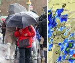
UK snow latest: New maps turn white as brutal 474-mile snow wall smashes into Britain | Weather | News
Teeth-chattering temperatures and a band of snow stretching from northern Scotland to Manchester are what weather maps are showing Britain can expect as the nation welcomes spring.
With just a few weeks gone into the new season, the budding trees and sprouting daffodils might be hidden by a covering of the white stuff from April 4.
Forecast maps from WXCharts show a large band of cold weather bringing wintry showers over most of Scotland, Northern Ireland and parts of northern England.
In some areas areas around Belfast and in the Scottish Highlands and Lowlands the snowfall could be heavier, with Newcastle in the north east of England also suffering similar conditions.
Fascinating maps looking ahead to the week starting Monday April 8 show a stark contrast between cold temperatures in Britain and warmer temperatures in France. A line separating the hot from cold can be seen running almost exactly down the middle of the English Channel.
In the immediate future there are two yelllow weather warnings in place from the Met Office for tomorrow (Thurs).
Northern Ireland has a warning in place for heavy rain between 7am and 5pm and the south coast of England has one for high winds between 7am and 6pm.
The Met Office long-range forecast for Monday April 1 until Wednesday April 10 said people should expect unsettled conditions across the country.
It said: “Next week begins with some uncertainty, but it looks likely that we will see a return towards more widely unsettled conditions as another area of low pressure pushes across the UK with changeable weather likely largely dominating throughout this period.
“Most areas look likely to see further showers and some longer spells of rain at times, although interspersed with some drier spells in between.
“It looks likely that a north – south split could set up across the UK. The wettest weather will tend to favour the south whilst northern parts remain a bit drier on average.
“In association with this split in general temperatures will be close to average, but it will be occasionally cooler in the north, and milder in south.”
This Evening and Tonight:
Clear spells and scattered locally heavy showers at first. Much of Scotland becoming dry overnight. However, showers continuing across Northern Ireland, and outbreaks of rain and hill snow developing across England and Wales.
Thursday:
Heavy rain and hill snow clearing northwards, leaving bright spells and heavy and blustery showers for many. Some hail and thunder in the south, where also very windy.
Outlook for Friday to Sunday:
Bright spells, but breezy with plenty of showers on Good Friday. Showers more scattered on Saturday and Easter Sunday, and feeling warmer in the sunny spells and lighter winds.


